The Ha Giang Loop is a mesmerizing journey through Vietnam’s northernmost province, offering breathtaking landscapes, rich cultural experiences, and thrilling adventures. Whether you’re a seasoned traveler or embarking on your first trip, the Ha Giang Loop Map 2025 provides a comprehensive guide to exploring the region’s most scenic routes. Dive into the guide of Indochinamotorcycletours.com to uncover the ultimate routes for an unforgettable experience in Ha Giang.
Discovering the Beauty of Ha Giang
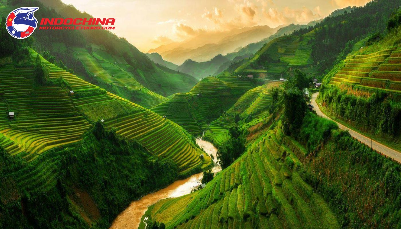
Nestled in Vietnam’s remote northern frontier, Ha Giang is renowned for its rugged mountains, verdant valleys, and vibrant ethnic communities. Ordered by China to the north and surrounded by the provinces of Cao Bang, Tuyen Quang, Lao Cai, and Yen Bai, Ha Giang is a place where history and nature blend seamlessly. The province is characterized by its rugged terrain, with towering limestone mountains, deep valleys, and winding rivers that carve through its dramatic landscape.

Explore the stunning landscapes of northern Vietnam on the Ha Giang Loop Map
The terrain of Ha Giang consists of rugged mountains, lush forests, and terraced rice fields, with altitudes ranging from low valleys to high mountain passes. One of the province’s most notable features is the Dong Van Karst Plateau, a UNESCO Global Geopark that showcases some of the most spectacular limestone landscapes in Vietnam. This region is known for its stunning karst formations, deep canyons, and dramatic mountain peaks, creating surreal and breathtaking scenery.
The Ha Giang Loop Map is an essential guide for those seeking adventure and exploration. The Ha Giang Loop is a popular adventure motorcycle riding route that takes travelers through some of Vietnam’s most scenic and challenging roads, offering unparalleled views of the province’s rugged landscape. The loop provides a unique opportunity to explore remote villages, interact with local communities, and experience the raw beauty of Ha Giang.
Must-Try Routes on the Ha Giang Loop Map
The Ha Giang Loop Map is your gateway to an unforgettable adventure. It outlines a network of scenic roads that weave through the province’s most captivating landscapes. Here are some of the must-try routes that will leave you in awe:
Journey from Ha Giang to Tam Son
The Ha Giang to Tam Son route, a scenic stretch on the Ha Giang Loop Map, offers a delightful introduction to the region’s beauty. With an elevation of around 1000m, this route is perfect for those seeking a shorter adventure, perhaps as part of Northern Vietnam motorbike tours or a motorcycle tour Northeast Vietnam. Despite its length, the journey is packed with stunning vistas of mountains, forests, and terraced fields, especially vibrant during harvest season.
The months from October to December are particularly enchanting, as buckwheat flowers paint the landscape in a breathtaking display. This period also coincides with various cultural festivals, offering a glimpse into the local traditions. The bustling Quyet Tien market, held every Saturday morning, is a must-visit for experiencing the authentic culture and vibrant atmosphere of the region.
Tam Son town itself boasts several attractions, including the Quan Ba Heaven Gate, Quan Ba Twin Mountain, and the Mong cultural village. For a truly immersive experience, consider staying in a traditional Mong home.
Scenic Drive from Tam Son to Yen Minh on the Ha Giang Loop Map
The Tam Son to Yen Minh route, another gem on the Ha Giang Loop Map, is a haven for motorbike enthusiasts. It promises an exhilarating ride through winding roads, breathtaking mountain vistas, and encounters with diverse ethnic minority communities. Many travelers opt for a Ha Giang loop tour from Hanoi, which allows them to experience the beauty of this route firsthand, combining urban exploration with the remote charm of northern Vietnam.
The months from October to December unveil the route’s most captivating scenery. During this time, Yen Minh transforms into a fairytale landscape, adorned with buckwheat flowers that cascade down the hillsides. The Yen Minh Pine Forest is a highlight of this journey. Prepare to navigate challenging cloud-kissed roads, feel the cool mountain air, and marvel at the towering pines that stand tall against the sky. Capture picturesque moments amidst traditional Hmong and Tay houses.
For a serene escape, head to Du Gia village, where tranquility reigns supreme. Though stunning, this part of the Ha Giang Loop can be daunting, and some consider it part of the Ha Giang loop dangerous sections due to narrow roads and sharp turns. The village’s vibrant blue waterfalls offer a refreshing respite, especially during the warm summer months. Don’t miss the chance to savor the unique flavors of the local cuisine. The culinary traditions of the mountainous ethnic minorities shine through in dishes like Au Tau porridge, Tam Giac Mach cake, and Men Men.
Adventure from Yen Minh to Dong Van
The journey from Yen Minh to Dong Van, detailed on the Ha Giang Loop Map, is one of the most exhilarating routes in Ha Giang Vietnam, known for its challenging terrain and breathtaking views. This section of the Ha Giang Loop Vietnam Map is a thrill-seeker’s dream, featuring high cliffs, winding zigzags, and perilous mountain passes that will test your riding skills and courage. Despite its difficulties, this route is a rewarding adventure for those who relish overcoming challenges and immersing themselves in nature’s grandeur.
As you traverse this rugged landscape, you’ll be rewarded with stunning vistas of the Dong Van Stone Plateau, a unique rocky expanse that showcases the raw beauty of Ha Giang’s limestone formations. When planning things to do in Ha Giang, exploring Dong Van is a must. The town is a historic gem, with an elevation ranging between 1,000 and 1,600 meters. The town is home to ancient architecture, such as the Dong Van Old Town from the French colonial era, which adds a historical layer to the natural splendor. Here, the contrast between the dramatic mountain scenery and the slow-paced life of the highland ethnic minorities creates a fascinating and unique atmosphere.
Iconic Route from Dong Van to Lung Cu on the Ha Giang Loop Map
Continuing from Dong Van to Lung Cu, as illustrated on the Ha Giang loop tour map, takes you to the northernmost point of Vietnam, known as Lung Cu. This iconic route is a must for those looking to reach new heights, both literally and metaphorically. For travelers seeking Ha Giang travel tips, it’s important to be prepared for the steep and winding roads leading up to Lung Cu.
Lung Cu is celebrated for its stunning panoramic views and its significance as the highest landmark in northern Vietnam. Standing at Lung Cu, you’ll not only enjoy the breathtaking natural beauty of Ha Giang but also gain insight into the simple, rustic life of the local people living in modest homes.
The journey to Lung Cu offers more than just scenic views; it provides an opportunity to experience the unique culinary delights of the Northwest mountains. The local cuisine, characterized by dishes such as kitchen buffalo meat, Dong Van roll cake, Bac Me Lam rice, and five-color sticky rice, reflects the simplicity and authenticity of the region. The use of local ingredients like Mac Khen and forest leaves adds to the distinct flavors of the mountain cuisine, making this route a memorable experience for both the palate and the soul.
>>> Read more: Top 12 Best Restaurants in Ha Giang for Authentic Cuisine
Stunning Path from Dong Van to Meo Vac
One of the most exhilarating sections of the Ha Giang Loop Map is the route from Dong Van to Meo Vac. This part of the Ha Giang Loop Vietnam Map is known for its dramatic landscapes and challenging terrain, particularly the notorious Ma Pi Leng Pass.
Ma Pi Leng Pass motorbike tours are popular for navigating this treacherous path, offering some of the most breathtaking views in Vietnam. The pass is renowned as one of the most dangerous yet stunning roads in the country, offering panoramic vistas of majestic mountains, golden terraced fields during the rice harvest, and the striking turquoise waters of the Nho Que River winding through the valley below.
Ma Pi Leng Pass, one of the four great peaks of the North, presents a true test of driving skill and bravery. The thrill of conquering this pass is matched only by the awe-inspiring natural beauty that unfolds before you, making it a highlight of any Ha Giang motorbike tour. Meo Vac motorbike tours through this region are not only challenging but also deeply rewarding, as it offers a glimpse into the unspoiled beauty of the mountainous terrain and the traditional lifestyles of the local ethnic minorities.
Serene Trail from Meo Vac to Du Gia
The journey from Meo Vac to Du Gia, as detailed on the Ha Giang loop tour map, offers a serene and tranquil contrast to the rugged terrain previously encountered. This 80km stretch includes the particularly challenging Meo Vac – Sung Trai path, which requires careful navigation, especially in misty conditions. For those interested in Meo Vac travel tips, it’s important to plan for the unpredictable weather and ensure your bike is well-prepared for the demanding ride. Despite the difficulties, this route is celebrated for its stunning scenery, featuring corn fields nestled among steep mountains and lush vegetation that comes to life with the season’s first rains.
Du Gia, originally a small town in the valley, is the perfect destination to conclude your motorbike adventure on the Ha Giang Loop Map. The village offers a peaceful retreat with opportunities for trekking, camping, and picnicking amidst its natural beauty. A visit to Tham Luong Waterfall, with its refreshing blue waters, is a must for anyone seeking to relax and unwind after the challenging rides. This tranquil spot provides a perfect ending to a journey through Ha Giang, offering a serene environment to reflect on the breathtaking experiences of the loop.
Conclusion
The Ha Giang Loop Map is your key to unlocking the hidden treasures of this captivating province. From the gentle slopes of Tam Son to the challenging peaks of Dong Van and the iconic Lung Cu flagpole, each route on this map promises a unique and unforgettable experience. Embarking on this Vietnam motorcycle tour is not just about the journey but also about immersing yourself in the unique culture, traditions, and daily life of the local ethnic minorities.
So, prepare your gear, study the Ha Giang Loop Vietnam Map, and get ready to embark on an epic adventure that will leave you with lasting memories and a deep appreciation for the stunning landscapes and rich cultural heritage of Ha Giang. For a hassle-free and expertly guided experience, consider Booking with Indochina Motorcycle Tours to make the most of your journey through this breathtaking region.


